Another new iOS 11 Maps feature that shows promise is Flyover, which allows the user to “see select major metro areas from the air with photo-realistic, interactive 3D views.” By zooming, panning, tilting, and rotating an iPhone or iPad device, the user is treated to a high resolution, aerial view of the city and its major landmarks. This is especially helpful as SMMA takes on projects across the US—urban planners and architects can “familiarize themselves with entire cities in a matter of minutes,” Merchel added.
A New Way to See Cities and Spaces
When Apple unveiled the new mobile operating system, iOS 11, on September 19, 2017, staff at SMMA were abuzz about the Maps app, which included brand new features such as Indoor Maps and Flyover.
According to Apple, Indoor Maps give “detailed directions inside major airports and shopping centers around the world. [You can] find out which restaurants are past security at the airport, where the nearest restroom is, or what floor your favorite store is on at the mall.” Although the Indoor Maps have not yet been rolled out to many locations, our staff could already see the potential.
“The Indoor Maps element allows architects and planners the ability to swiftly understand a building’s massing with a focus on interior programmatic adjacencies while sitting in the very building that is being studied,” said our Design Technology team.
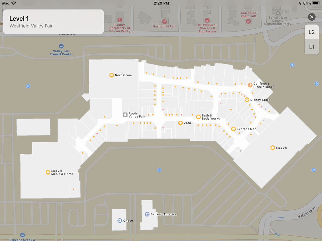
Currently, viewing a location’s Indoor Map shows the relative size, shape, and layout of stores, hallways, stairwells, escalators, restrooms, entrances, and exits, and how these vary floor to floor. But if more detail were added, Indoor Maps could be an essential tool for architects and interior designers, and even electrical designers. Andrew Barros elaborated: “Indoor Maps could potentially be used to find out floor heights, window distances, and measurements. Apple takes great care in keeping their products up-to-date, so this could be an accurate imaging tool if more specifications were added. As an electrical designer, I would love to be able to spot the locations of transformers and above-ground power lines.”
Indoor Maps may enhance client meetings as well, which could make the difference when trying to secure a new client project. Michael Kyes, Architecture Team Leader, was meeting with a client who had a floorplan from the landlord, but couldn’t discern where the south façade was situated.
“If Indoor Maps had been available, I could have quickly accessed the interior layout, fill in the gaps with the client, and learn more about the space—no computer required.”